
Looking Up Your Azusa Neighbors
A neighbor lookup should begin with the source that can answer the block question. Parcel maps show layout and AINs. Assessor material supplies property facts. City GIS adds planning and historic layers. Permits show work at an address and may name an applicant or contractor. A voter street product is restricted and the self-check is not a block search. Historical directories and census schedules show past households, not a current neighbor roll.
| Source | What it shows about a block | Access |
|---|---|---|
| County parcel viewer | Lot layout, AIN, situs, adjacency | Free map browse |
| Assessor parcel data | Property facts, map references, limited lawful owner evidence | Address or AIN and county channels |
| Azusa Interactive GIS | Zoning, footprints, historic sites, parks, schools, services | Free city layers |
| Azusa permit search | Project, status, applicant, contractor clues | Portal or city request |
| Voter street index | Qualifying registration data | Purpose, contract, and fee restrictions |
| Reverse directory or census | Historical occupant and household context | Library, archive, or partner collection |
A block list made from AINs is more accurate than a list made from names. It lets the record show which neighboring parcel is being discussed before any personal clue is tested.
Click Outward from an Azusa Neighbor Parcel
Open the Los Angeles County Assessor Parcel Viewer, search the known address or AIN, select the parcel, and then click the adjoining polygons. Record each adjacent AIN and situs without assuming that every polygon is a home. A corner lot, common parcel, school site, business parcel, or right-of-way can change the shape of the block.
The assessor parcel view is a map tool. It shows geography and property facts. It does not give a full household list, and public owner identity is limited on the web. Use the map to build the block’s physical frame, then move to Azusa GIS or permits for context.
The captured county parcel viewer illustrates the outward click method.
Adjacent parcels are the safe starting unit for an Azusa neighbors search because they remain visible even when household identity does not.
Make an Azusa Neighbors Block List
Once the map is open, create a short process record. The goal is to preserve the parcel relationship, not to collect a name list. Keep the known address, map date, AIN, adjacent AINs, situs text, and any layer used. If a parcel does not resolve, note the failure and try the legal description or an intersection.
- Start with one confirmed Azusa address and its AIN.
- Select the parcel and trace each adjoining polygon on the map.
- Write each AIN and situs separately, including corner or non-home parcels.
- Check city GIS for zoning, footprint, historic, park, school, or service context.
- Use permits, deeds, or public civic contacts only when the question needs a person or organization clue.
That process keeps neighbors tied to the block rather than to a commercial compilation that may mix old and new addresses.
If an adjoining polygon falls outside incorporated Azusa, use Los Angeles County GIS-NET Public for the unincorporated county route. Its documented tools include AIN, address, intersection, and community queries, plus identify, query, buffer, tract and parcel map, print, export, and aerial options. Save the query date and jurisdiction with each AIN; a map connection is evidence of parcel adjacency, not proof that the same household occupies both properties.
Azusa Neighbors and Zoning Context
The City of Azusa Interactive Maps and GIS advertises zoning, building footprints, traffic counts, street sweeping, historic properties, parks, schools, and engineering or planning layers. Official planning zones include Neighborhood zones NG1, NG2, and NG3, along with the University District, Edgewood District, West End Industrial, and corridors such as Azusa Avenue, San Gabriel Avenue, South Azusa Avenue, Arrow Highway, and Foothill Boulevard.
Those labels describe place and civic context. They do not identify the private people who use a building. A historic-property layer may lead to the city or library history collection. A university district may point to public institutional contacts. A corridor may point to business or permit records. Choose the next source from the layer, then keep that source’s limits visible.
The Azusa GIS page is the city-side map reference for a neighbors search.
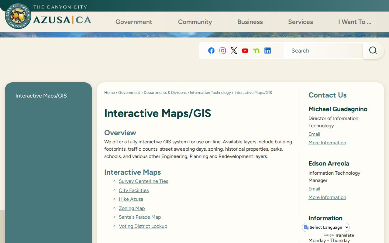
GIS context can explain why two adjacent parcels belong to different record paths without exposing a private household roster.
Azusa Neighbors: Taxpayers Are Not Households
An assessor or tax result describes a parcel and may carry owner or mailing evidence through a lawful county channel. It does not show every resident. Many people can share one unit, and a person connected to a parcel may live elsewhere. The tax roll can establish a property clue, not a complete list of neighbors.
The same rule applies to permits. The Azusa permit portal accepts owner or applicant fields, but an applicant may be a contractor, agent, seller, or business. A Real Property Records Report can list an occupant count or current address in a compliance setting, but it is not an official directory of all occupants. Keep the field label with the name.
When the question changes from adjacent parcels to one person, use the Azusa resident lookup route. When it changes to the whole named street, use the street directory route instead.
Azusa Neighbor Voter Data Limits
The LA County voter status form requires last name, birthdate, house number, and ZIP Code. It is built for self-verification, not for a block search. A county voter street-index product is available only for approved purposes under Elections Code section 2194, with application, contract, and fee rules. Personal, private, commercial, solicitation, and harassment uses are not permitted.
Even an authorized file has exclusions. Ballot choices are not disclosed. Driver-license or ID numbers, the last four Social Security digits, unique identifiers, and signature images are excluded. Safe at Home can substitute a mailing address for qualifying survivors and specified public-facing workers. A neighbor search must respect the gap between a legal record and a person’s safety.
Find Public Azusa Neighbor Contacts
Community records can help a resident understand a block without exposing a private roster. The city-hosted legacy Directory of Organizations includes groups such as the Historical Society, Friends of the Library, and Sister City groups. It is an older civic layer, so verify every officer, phone, and address before relying on it. The city’s Neighborhood Connections program is a confidential referral service, not a member directory.
| Public contact layer | Useful for | Limit |
|---|---|---|
| Historical Society | Local history and public archival leads | Not a private membership roster |
| Friends of the Library | Library and collection context | Verify current contact details |
| City Community Connections | Public referral information | Confidential service, not resident data |
| Public commission rosters | Named civic contacts | Does not represent the whole block |
The research did not locate an official citywide neighborhood-association member directory. Do not imply an HOA roster or publish private contact data that the source does not make public.
Compare Official Azusa Neighbor Tools
Official sources and commercial compilation tools have different strengths. The official record has a named custodian, a defined field, and an access rule. A commercial tool may join old addresses, public filings, and uncertain matches into a convenient profile. Convenience does not make the result current or authoritative. Use official sources for parcel, court, voter, permit, and historical claims.
| Route | Best use | Weak point |
|---|---|---|
| County parcel map | Adjacent AINs and physical layout | Not a full household list |
| City GIS and permits | Place, project, and public participant clues | Applicant is not always an occupant |
| Restricted voter products | Authorized election or research work | Purpose, contract, and privacy limits |
| Commercial compilation | At most a lead to verify | Stale, mixed, or unsupported matches |
An Azusa neighbors result should cite the parcel or custodian source that supports it, not hide the source behind a scraped profile.
Compare Today's Azusa Neighbor Block
Historical directories, census schedules, and the Azusa Herald can show how a block changed. Pair an older street or house number with the parcel map and legal description. The exact Azusa reverse-directory run is not verified, so ask library reference staff rather than naming an unconfirmed publisher. A census household may include relatives or lodgers who never appear in a directory.
The historical comparison is useful for family history, neighborhood study, and house history. It is not a way to infer who currently lives next door. Current parcel facts, historic names, and community contacts should remain in separate columns in the research notes.
For the complete named-street chain, follow the Azusa street directory route. The neighbors route stays with the immediate block and its public context.
What Azusa Neighbor Searches Leave Invisible
Private household members, children, unregistered adults, utility customers, delivery data, and protected residents may never appear in the public block sources. A parcel map can be complete while the household picture is not. Safe at Home can shield a qualifying address. Court, vital, DMV, and investigative records have their own limits. A blank or partial result is not a clean statement about a person’s life.
Privacy and lawful use. Azusa neighbor lookups are for understanding a block, family history, reconnecting, property curiosity, and personal safety awareness. Do not use them to watch, stalk, intimidate, threaten, or harm anyone.
When a person’s safety or privacy is at stake, stop at the parcel and public-civic layer. When a record is wrong, contact the custodian that created it. When the question needs current personal verification, use the narrow official route that the record allows.