
Azusa ZIP Code Directory Coverage
The official searches reviewed for Azusa consistently identify one general-delivery ZIP associated with the city. A postal city line can include land outside the incorporated boundary, so the coverage table states the limit instead of treating the ZIP as a city map.
| ZIP | Areas covered | Post office | Notes |
|---|---|---|---|
| 91702 | Azusa and postal territory around it | USPS Azusa delivery and post-office facilities | Verify the exact station or address with USPS; postal geography does not prove incorporation |
The USPS city and state ZIP lookup is the first check for a delivery line. The assessor and GIS then answer the parcel and jurisdiction question.
91702 Is Azusa's Main Postal ZIP
ZIP Code 91702 is the primary general-delivery ZIP consistently tied to Azusa in the official searches. The USPS facility record identifies the Azusa Post Office at 110 W. 6th Street, Azusa, CA 91702-9998, with retail and PO-box hours listed on the live page. Hours can change, so verify them before a visit. The ZIP line is useful for normalizing an address, not for deciding whether the parcel sits inside the city.
Postal geography can extend around a municipal edge. A mailing record may say Azusa while the parcel is in nearby unincorporated county territory. A utility service map can also cross a city line. The right next move is the Azusa boundary map or the county and city GIS layers, followed by an assessor AIN search.
The captured USPS ZIP lookup shows the postal verification route.
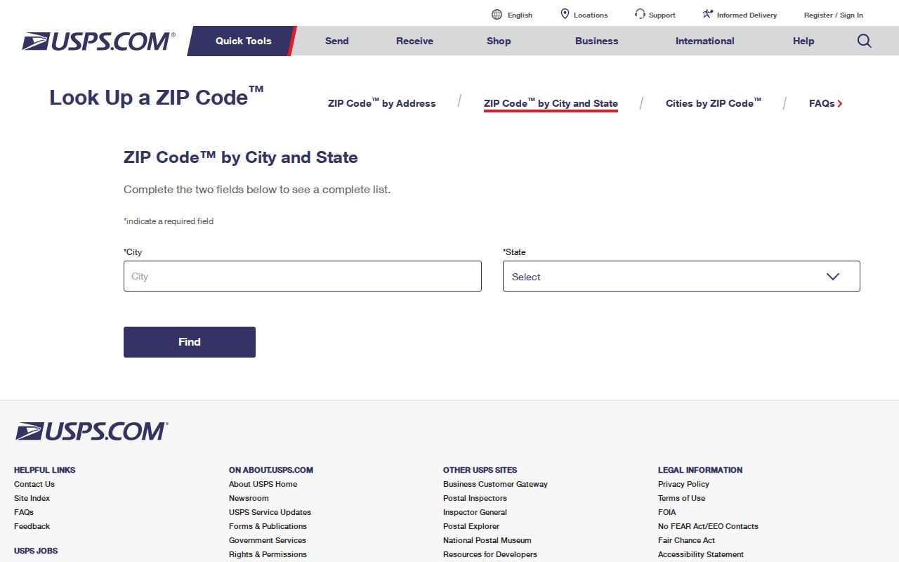
Use the form to check the postal field, then use city or county mapping to check the place field.
Azusa ZIP and City Limits
A sound postal workflow has two checks. First, standardize the delivery ZIP through USPS. Second, test the address or intersection in the correct GIS. For an incorporated Azusa parcel, use the City of Azusa mapping page and the County Assessor Parcel Viewer. For an adjacent unincorporated county parcel, GIS-NET Public can accept AIN, address, intersection, and community and offers identify, query, buffer, tract and parcel map, print, export, and aerial tools.
GIS-NET is designed for unincorporated county land, so jurisdiction matters. The city and county maps are not interchangeable. Save the map source, layer name, and date when a ZIP boundary question affects a deed, permit, voter, or records request.
The official sweep did not identify a separate Azusa ZIP split, a year for a ZIP realignment, a PO-box-only Azusa ZIP, or a documented assessor browse by ZIP. Treat that as a research boundary rather than proof that no postal exception exists; confirm a current address in USPS. ZIP 91702 is the starting postal clue, not evidence that every 91702 delivery sits inside incorporated Azusa.
The Azusa Light and Water service map is another reason to keep postal and municipal geography separate: a utility service territory can cross a city edge. When the mail line is unclear, pair GIS with the city planning application’s project address, APN, and legal description fields. An APN or legal description is a stronger parcel anchor than the city name in a mailing line.
- Check the city and state or full address in USPS.
- Keep the ZIP and the normalized street line together.
- Confirm the city line against Azusa or Los Angeles County GIS.
- Resolve the parcel in the assessor search using address or AIN.
- Use the parcel, city permit, or county source that matches the record question.
Why Azusa ZCTA 91702 Is Approximate
The Census Bureau’s ZIP Code Tabulation Area is a statistical approximation built from residential and other address points. It is not the same thing as a USPS delivery route or a city boundary. A ZCTA can cross or miss an incorporated line, while a mailing ZIP can cover a wider postal territory. The Census ZCTA guidance explains that the statistical shape should not be treated as an exact municipal outline.
- ZIP Code
- A USPS routing code used to sort and deliver mail.
- ZIP+4
- An added four-digit delivery segment that can narrow a route beyond the five-digit ZIP.
- ZCTA
- A Census statistical approximation of ZIP geography, not a postal promise or city line.
- PO-box ZIP
- A postal code used for box delivery, which may not describe a home parcel.
- Carrier route
- A delivery grouping within postal operations, not a public resident list.
These terms keep the postal guide useful without making the field carry more weight than it can.
Finding Azusa Residents by ZIP Code
A ZIP code is too broad for the Los Angeles County Assessor Portal to act as a mass resident search. The documented assessor route accepts an address or AIN, not a ZIP-wide browse. The LA County voter form accepts ZIP only with last name, birthdate, and house number. The recorder does not search by ZIP or address. Those limits mean the postal guide narrows geography, then hands the work to a more exact source.
Once a ZIP has been checked, use a name or address clue. A known street belongs in the Azusa street directory route. A known person belongs in the resident lookup route. A past household belongs in the city directory or previous-resident route. This division avoids calling a postal area a residents list.
| Known clue | Next official step | What the result can show |
|---|---|---|
| Full street address | Assessor address search | AIN, situs, property facts |
| Name and voter facts | LA County voter status | One registration status check |
| Name and case category | LA Superior Court search | Case role, date, location, number |
| Old address | Directory, census, deed, and Herald trail | Past household or ownership clues |
Search an Azusa Address, Not ZIP
The assessor is an address and AIN tool. It can return situs, map page, use code, characteristics, values, and tax-rate area. The public web display does not provide an advertised owner-name mode, and the research did not document a ZIP-only resident browse. Search the full street line, try the AIN from a deed or tax record, and use cross streets when a multi-unit, corner, or new parcel does not resolve.
Do not mix the assessor’s mailing and situs concepts. A tax notice address may not be in Azusa. A parcel result may contain no person name at all. The legal description is often the better bridge when a postal street line changes.
The Los Angeles County property search should be treated as the parcel step of an Azusa postal search, not as a ZIP-wide people index.
Azusa Voter ZIP Status Fields
The voter ZIP field helps the person verify the right registration record. It does not open a postal index. The form requires all four inputs: last name, birthdate, house number, and ZIP Code. A third party who lacks the facts cannot use the form to scan 91702, and a failed result may mean that a protected, inactive, or differently entered record was supplied.
Broader voter files are restricted under Elections Code section 2194. Authorized election, scholarly, journalistic, political, or governmental users submit an application and contract. The file can include address and status fields, but it does not reveal ballot choices and excludes specified identifiers and signatures.
The California voter-file request page explains the state-level access controls.
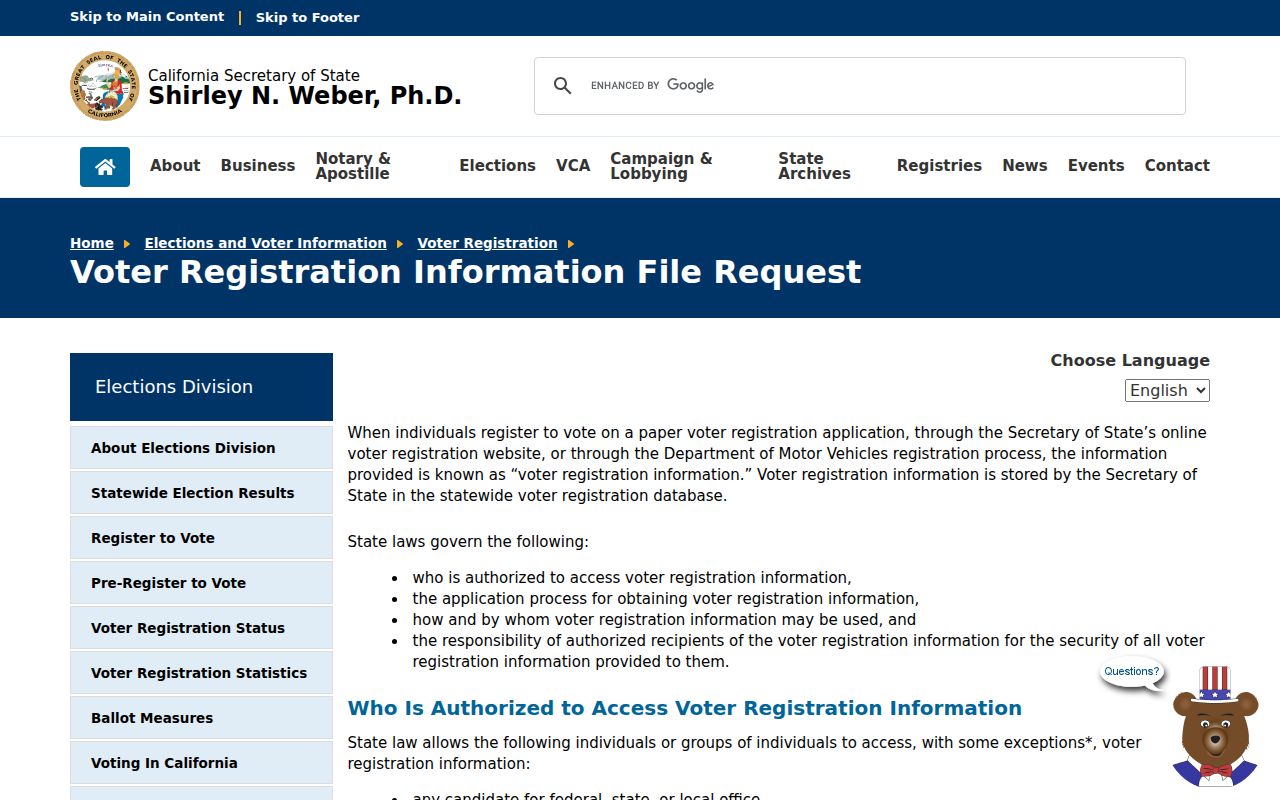
The broader file is a purpose-limited product, not a way to turn ZIP 91702 into a public household list.
Azusa ZIP Districts Inside 91702
Postal geography crosses several Azusa record landscapes. The foothill and Route 66 corridor, Azusa Avenue and San Gabriel Avenue, University District, Edgewood District, West End Industrial, Arrow Highway, and other corridors can carry different planning or service layers. A postal guide can group those addresses for mail, but the city’s planning and GIS sources are needed to identify the local district or municipal service.
Azusa Pacific University and Citrus College add a university-area record context. Older downtown and foothill parcels may connect to tract maps, the Azusa Herald, prewar census schedules, and historical directories. A commercial corridor may have business filings or permits rather than household clues. Treat the ZIP as a first geographic tag, then choose the record type that fits the place.
Use an Azusa ZIP Code AIN Bridge
An address can be normalized by USPS and still be a poor historical key. A street rename, directional change, annexation, subdivision, or postal form can break a text search. Compare the AIN, legal description, tract or subdivision, parcel map, deed, city permit, Sanborn sheet, and directory entry. The research did not locate an authoritative Azusa street-renumbering chronology, so an exact change year should not be guessed.
When the AIN stays constant, it can connect a ZIP-era address to an older deed or parcel map. When the parcel splits, record both AINs and the legal description before reading a later record as the same property. The Azusa previous-residents route uses that bridge for a backward house history.
For a boundary question, save the city-map layer, county parcel result, and date checked with the normalized address. The research did not locate an authoritative Azusa street-renumbering chronology or a ZIP-wide assessor index, so a precise change year or resident count should not be inferred from postal text. The Azusa planning application shows why project address, APN, and legal description belong together when a parcel crosses a naming or jurisdiction gap.
This is the durable use of a postal guide: it helps sort the first address clue, then yields to a parcel key that can survive changes in mail language.